When it’s not safe, practical or efficient to have a conventional manned land surveying crew produce the topographic map you need, it’s time to consider Aerial Topographic Mapping. You have options and we will help by pointing you to just the right aerial mapping technology solution to get your job done safely and efficiently for the lowest cost possible.
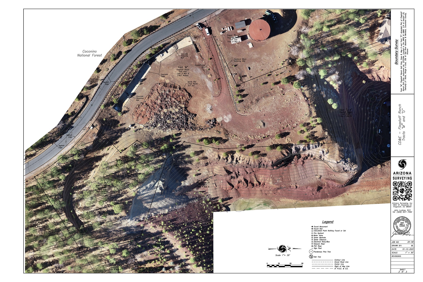
Arizona Surveying can produce an aerial topographic map using our own DJI Phantom 4 Pro unmanned aerial drones along with the Aerotas Mapping System. The combination of drone and photo mapping technology allows us to safely and efficiently access areas where a survey crew might have difficulty such as rough terrain or mining operations. The process is simple and can deliver a completed map from field to finish in just a few days.
For the largest parcels or areas that must be flown and photographed at higher altitudes, Arizona Surveying will make all arrangements and work in tandem with a trusted and licensed photogrammetrist to acquire base mapping data. For these larger projects we typically provide horizontal and vertical ground control which is then used to orient the aerial photo-derived topographic mapping including contours and features such as buildings and site improvements. We deliver the final mapping product and you need only work with us reducing the time and expense of dealing with outside mapping contractors.
Arizona Surveying provides aerial topographic mapping for land development, mining and pit operations, GIS base mapping, forestry, land planning, utilities and environmental in Flagstaff, Prescott, Sedona, Phoenix, Tempe, Glendale, Scottsdale, Casa Grande, Yuma, Tucson, Kingman, Laughlin, Grand Canyon, Navajo Reservation, Hopi Reservation, Hualapai Reservation, Coconino County, Yavapai County, Maricopa County, Pima County, Arizona, Utah, Colorado, New Mexico, Nevada and California.