
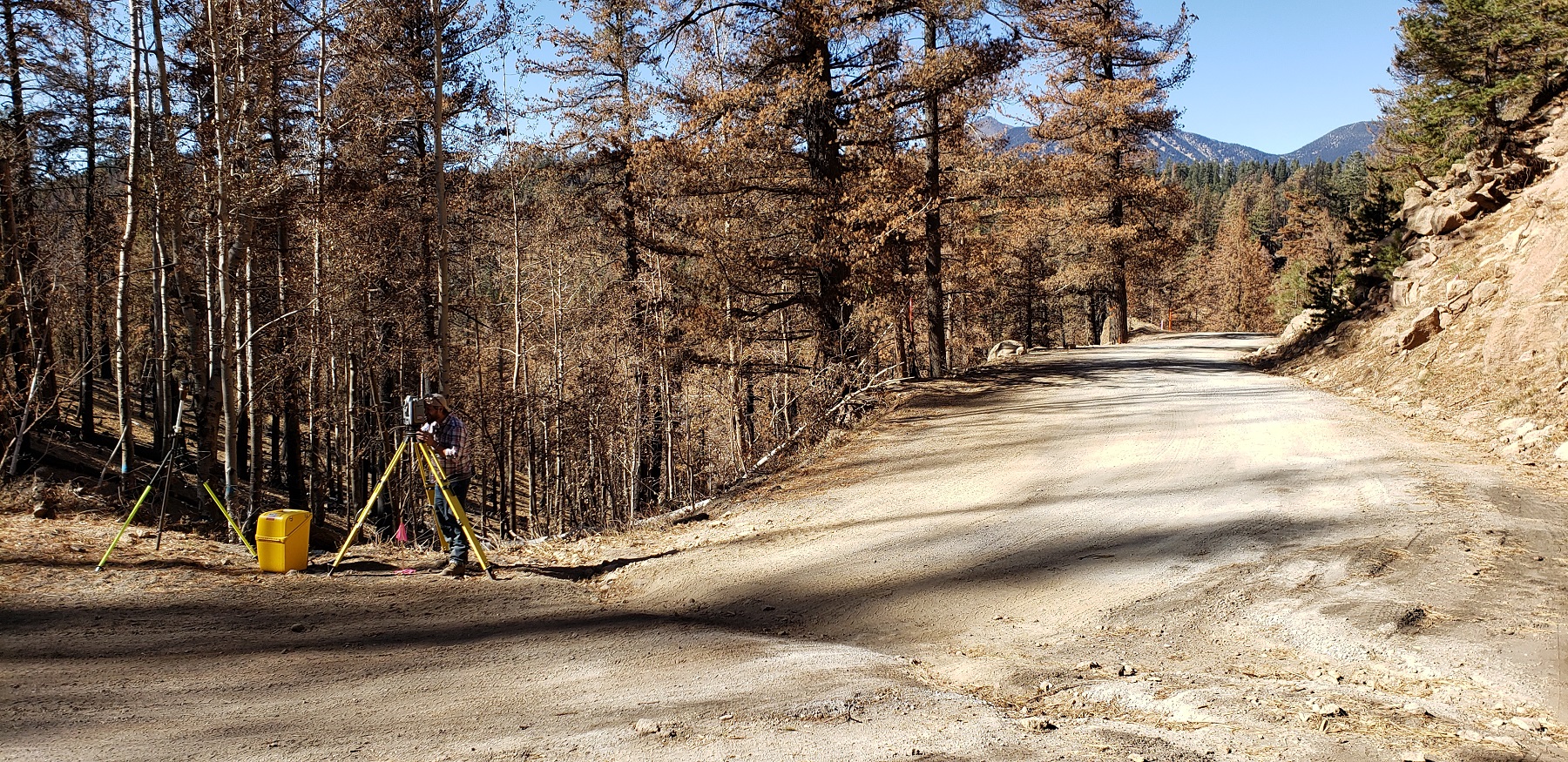
Using the latest 3D Laser Scanning technology (LiDAR), Arizona Surveying can produce accurate and precise 3D CAD models of complex terrain and man-made features. Mining operations, topography, buildings (interior and exterior), utility structures, roadways, bridges and overhead assets can all be represented with our scanning and mapping technology.
View and manipulate the results in the 3D CAD environment of your choice. Now you have the accurate 3D data you need to make well-informed design and maintenance decisions that save time and money as well as reduce liability.
-Perfect for architects, land managers, mining and pit operators, owners, contractors, building designers and facility managers.
-Accurate mapping = efficient design = reduced liability and expedited construction schedules.
-Simple data collection that is safe with minimal disruption to operations.
-Quickly and accurately create Point Cloud.
-We are 3D mapping leaders with years of experience.
3D laser scanning is perfect when the challenge is a building remodel design and the original plans are either incomplete or cannot be found.
-Electronic file output in AutoCAD or MicroStation.
-2D and 3D drawings of building facades.
-All elevations.
-Roof scans capture rooftop mechanical equipment and areas in need of repair.
-All 3D images are presented with registered coordinate points.
-All scans have extremely high precision and accuracy.
Whether for design, planning, inventory or other mapping needs, 3D laser scanning provides a cost-effective solution that is quick and easy.
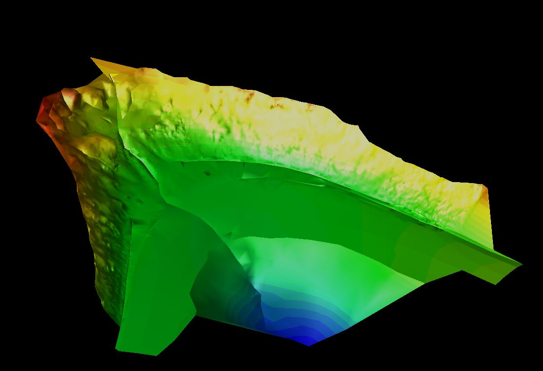
-Accurately map complex terrain like canyons and pit sites.
-Provides visual inventory information like trees and other natural and man-made features.
-Faster, more accurate and safer than conventional land surveying.
Safety and efficiency, that’s what mining and pit operators can expect when applying 3D laser scanning surveying and mapping technology. Scanning can occur on site perimeters, well clear of heavy equipment and other operations that are dangerous to conventional surveying personnel. Turnaround times are much quicker and results are more accurate too.
3D laser scanning technology can be particularly valuable to facility managers responsible for the maintenance and efficiency of complex mechanical layouts like those found in hospitals, hotels, high-rise residential and other large buildings. Another typical use of laser scanning is for the mapping of historical properties for maintenance and legacy records. Manufacturing operations use laser scanning to map and evaluate factory room layouts to enhance efficiency and safety. Telecommunications assets are frequently mapped with laser scanning as a form of record keeping and to aid in repairs and maintenance.
Our 3D high definition laser scanning offers many benefits to the construction industry:
-Linkage of information between architects and engineers.
-Monitor progress and verify deadlines.
-Building and site modeling.
-Legacy 3D representation of site.
-Earthwork volume calculations and verifications.
-Erosion measurement.
-Building height measurements.
Arizona Surveying is proud to offer laser scanning, 3D scanning, lidar, 3D laser scanner, Riegl Laser Scanner, terrestrial laser scanner, 3D modelling, laser scanning services, 3D CAD models, high-definition surveying, lidar laser 3D mapping, point cloud, CAD drawing services in Flagstaff, Prescott, Sedona, Phoenix, Tempe, Glendale, Scottsdale, Casa Grande, Yuma, Tucson, Kingman, Laughlin, Grand Canyon, Navajo Reservation, Hopi Reservation, Hualapai Reservation, Coconino County, Yavapai County, Maricopa County, Pima County, Arizona, Utah, Colorado, New Mexico, Nevada and California.