
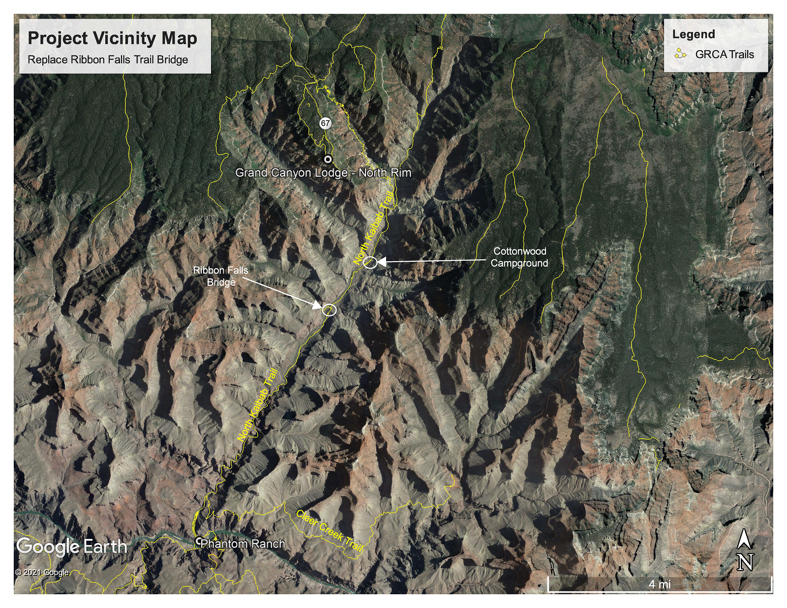
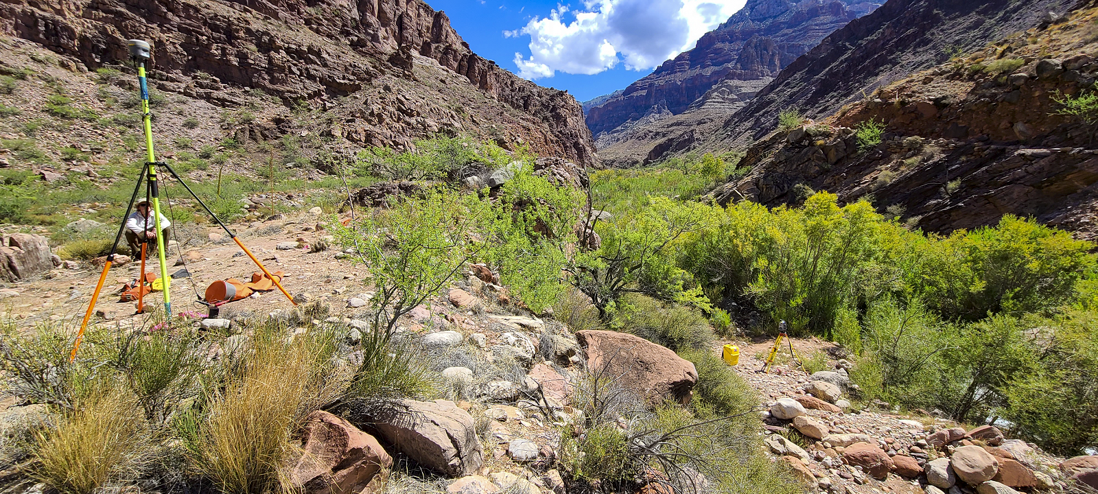
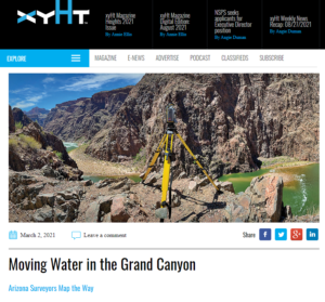
Arizona Surveying was asked to help in the development of the new Ribbon Falls replacement bridge after the original timber and galvanized steel truss bridge failed. The original bridge spanned 78 feet over Bright Angel Creek and connected the North Kibab Trail to the Ribbon Falls trail. Arizona Surveying sent Bretton Luckow and Bryan Martin to the Ribbon Falls Bridge site for a topographic survey of the area so engineers could use the data gathered to build a replacement bridge that could be dropped into place via helicopter in the exact location of the original bridge.
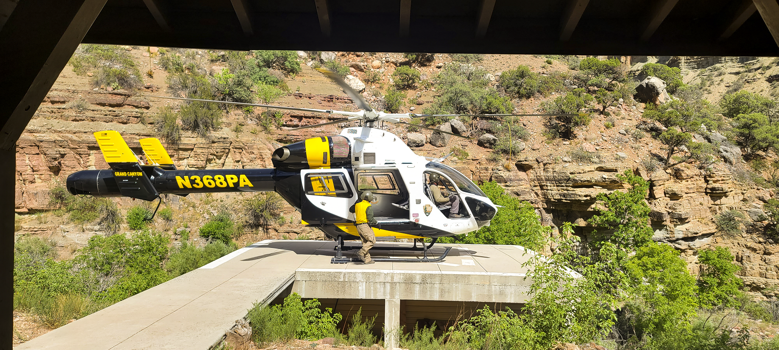
The team was flown to Manzanita Rangers Station where they spent the night. Their gear and equipment were airlifted to the site for the following day survey work. The night at the bunk house at Manzanita was eventfully as every trip into the canyon is. There was no power at the bunk so Bretton and Bryan along with the rest of the crew that would be working at the site decided to sleep outside on the helicopter landing pad. But mother nature had other plans and it began to rain on everyone. In a mad dash to grab sleeping pads and bags, everyone found refuge on the porch of the bunk house.
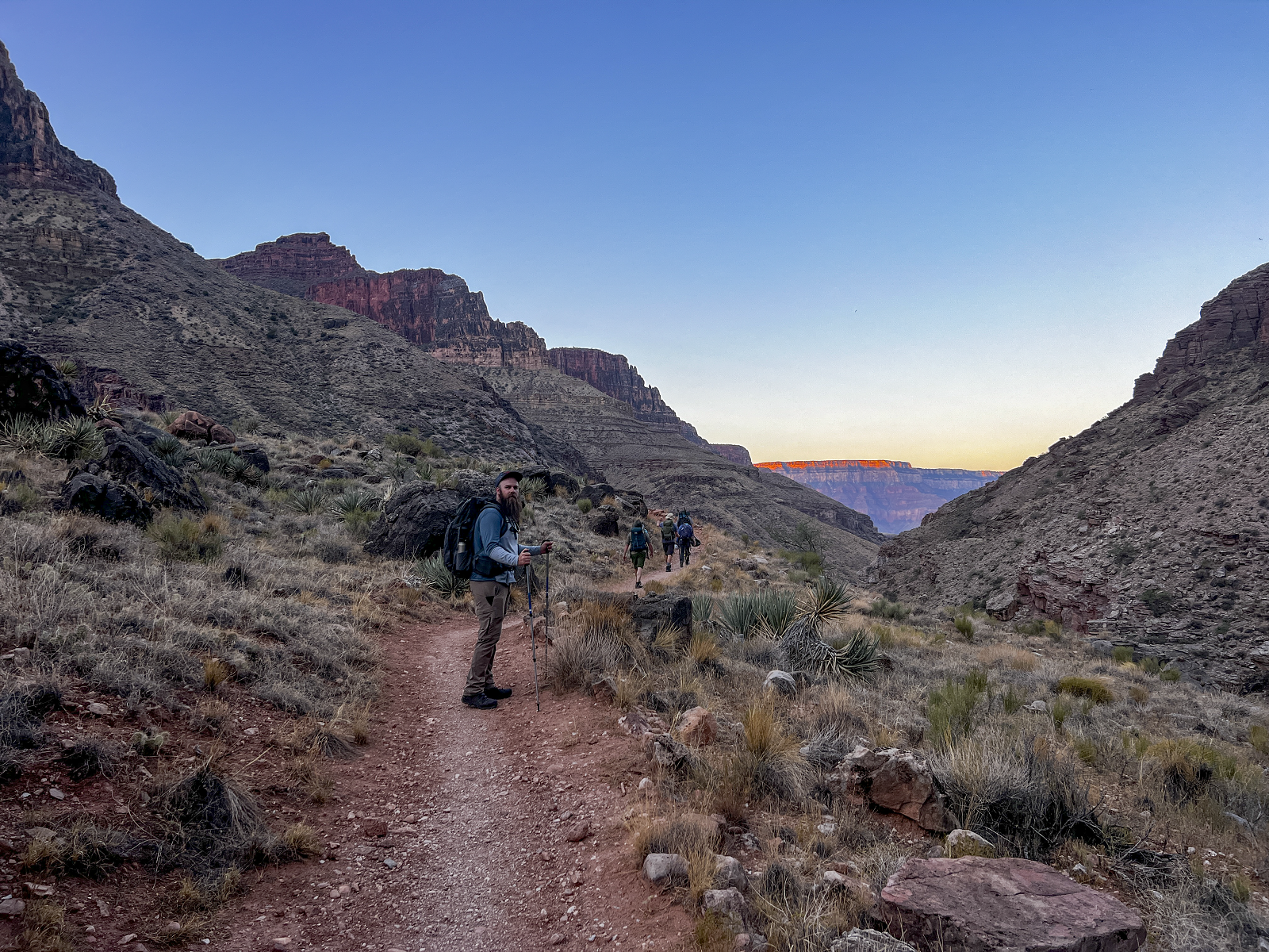
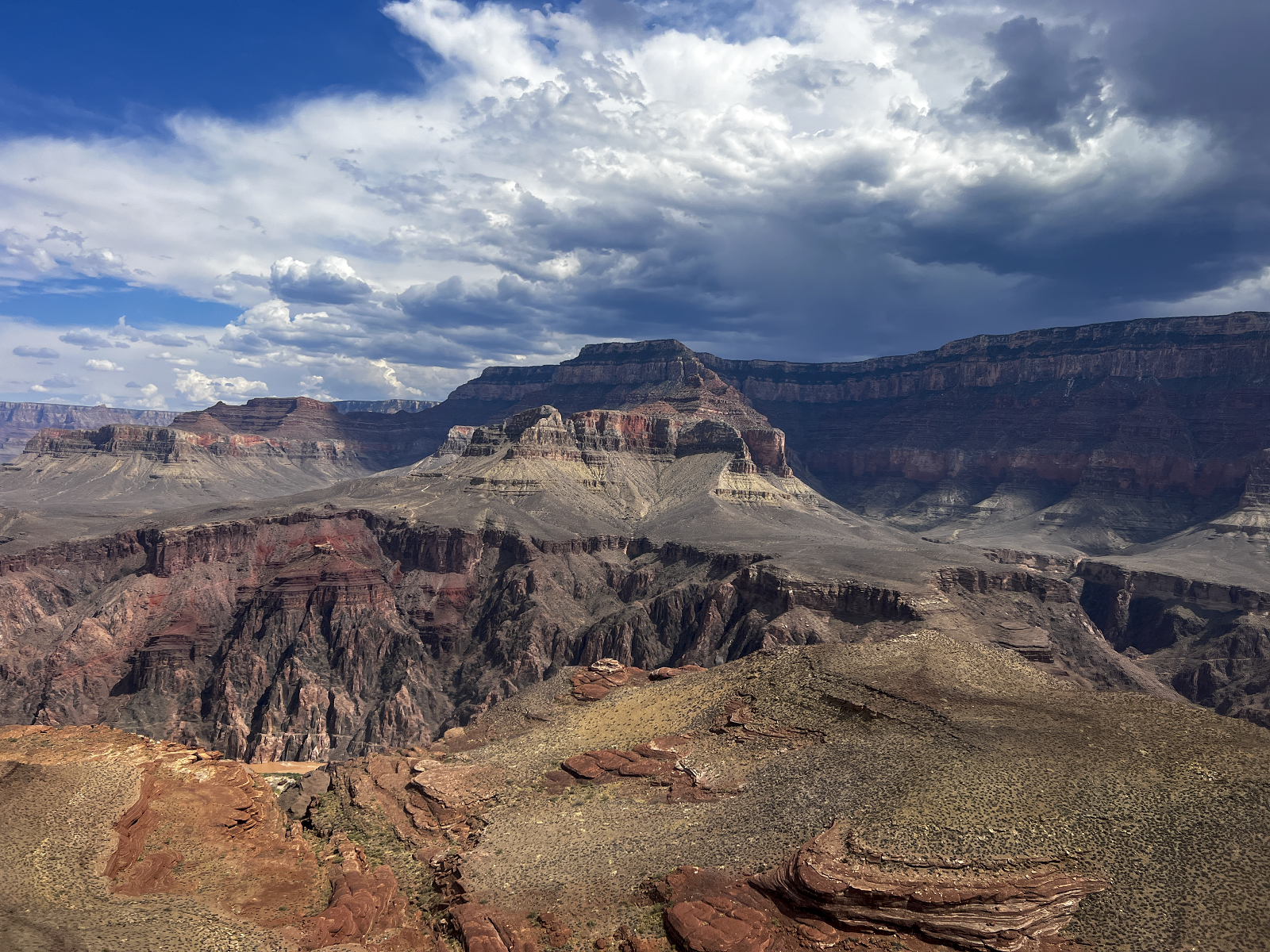
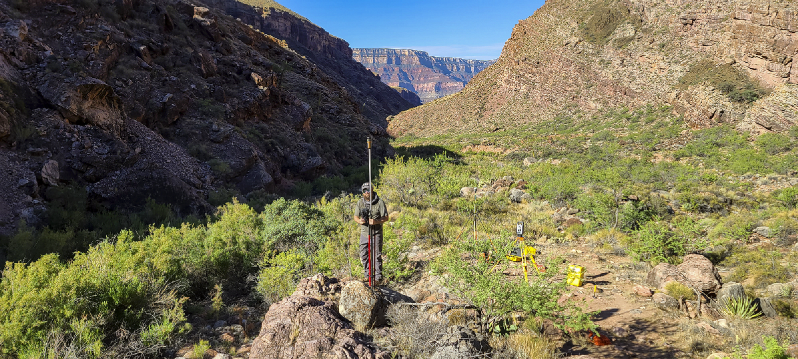
At 4 am the next morning they hit trail to hike down to Ribbon Falls Bridge via the North Kibab Trail passing through Cottonwood Campground. The trip to the worksite was only a few miles, and the early morning sunlight brought life to the inner canyons monolithic walls. Once at the site survey equipment had to be unpacked and set up. With inner canyon temperatures hitting 106 degrees by mid-day the team wanted to collect as much data as they could before the heat became a factor. Water is life in the canyon, without it one would not last long. Thankfully, Bright Angel Creek was flowing and the occasional dip into it helped cool the team off during the 106 degree day.
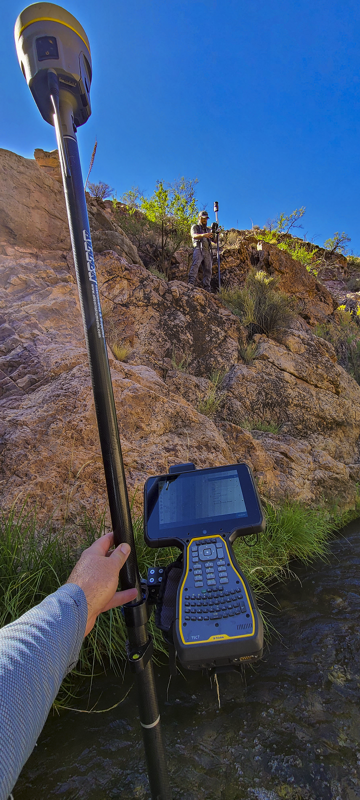
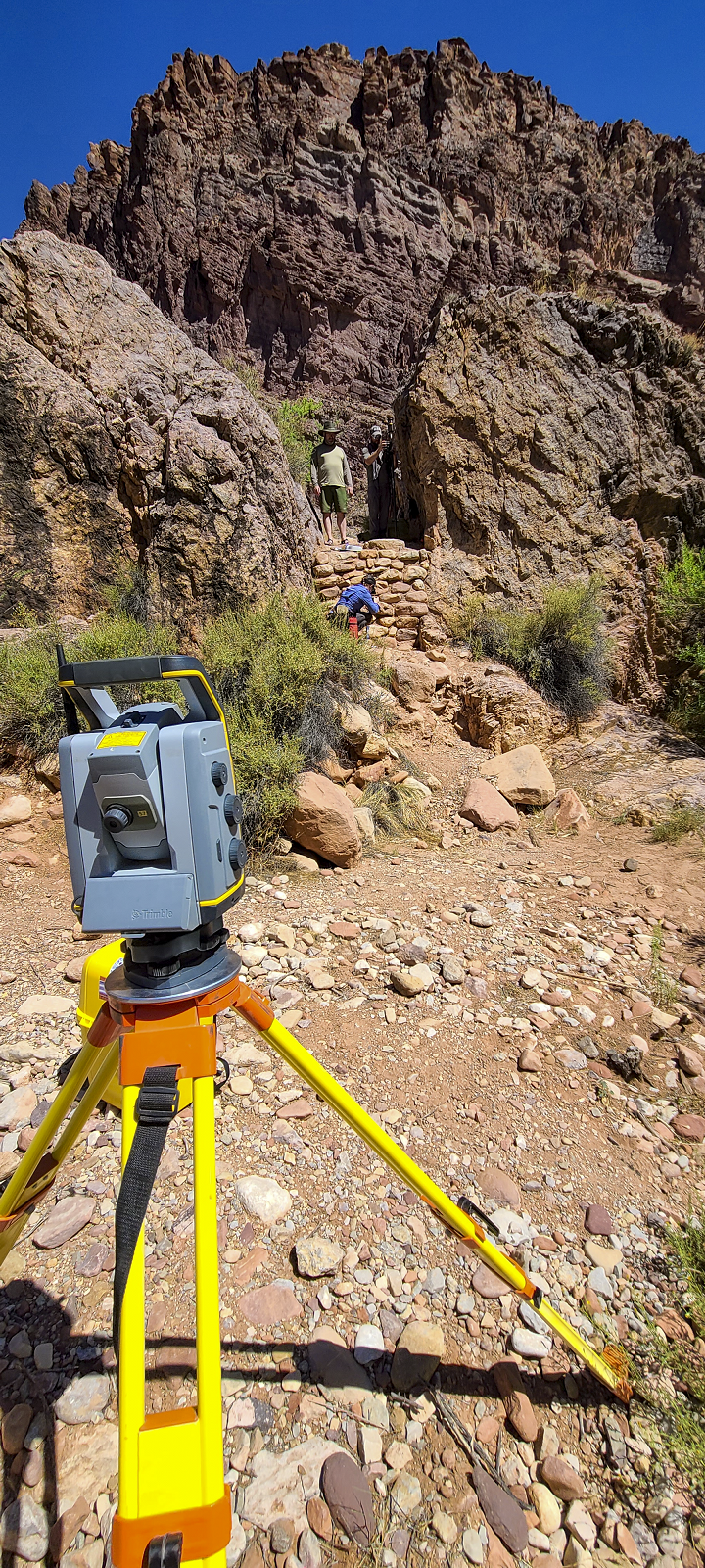
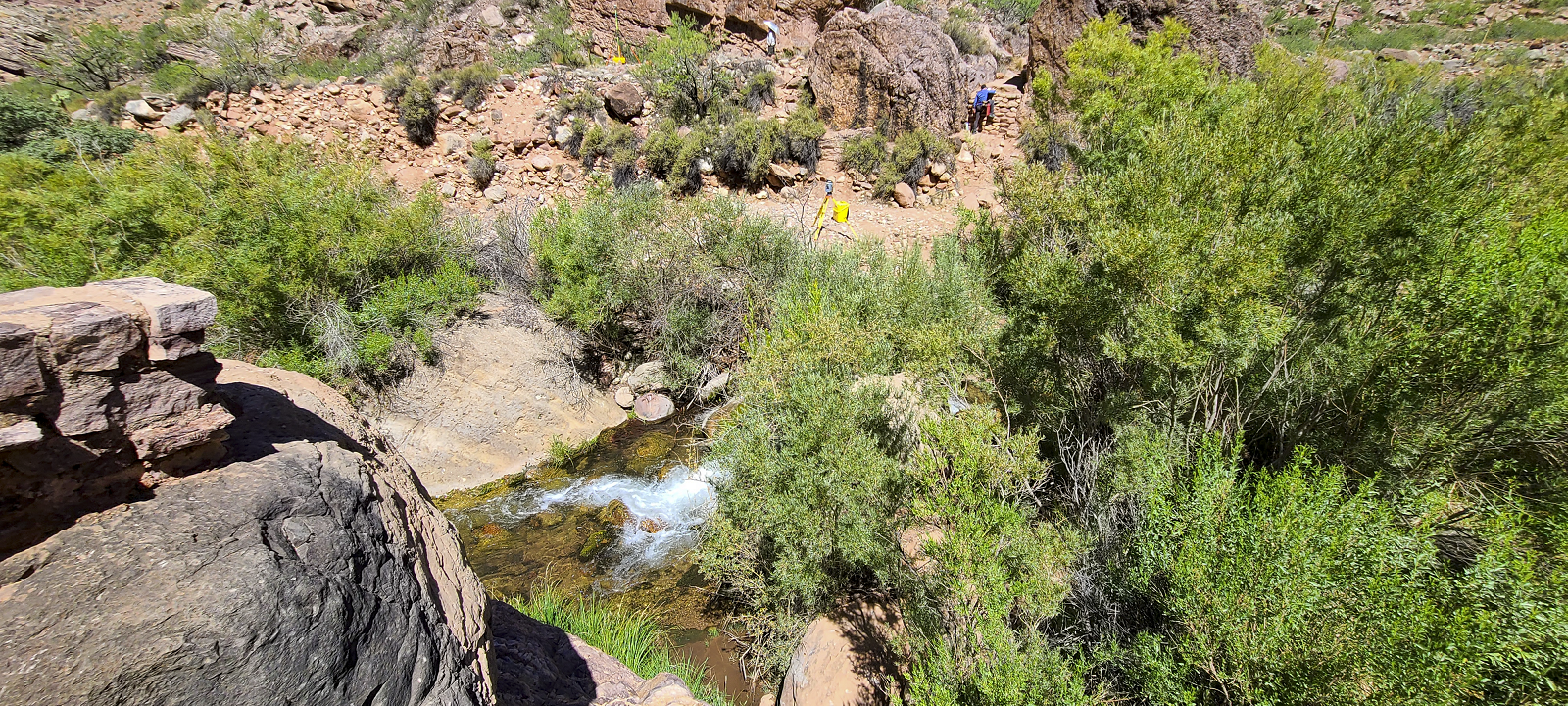
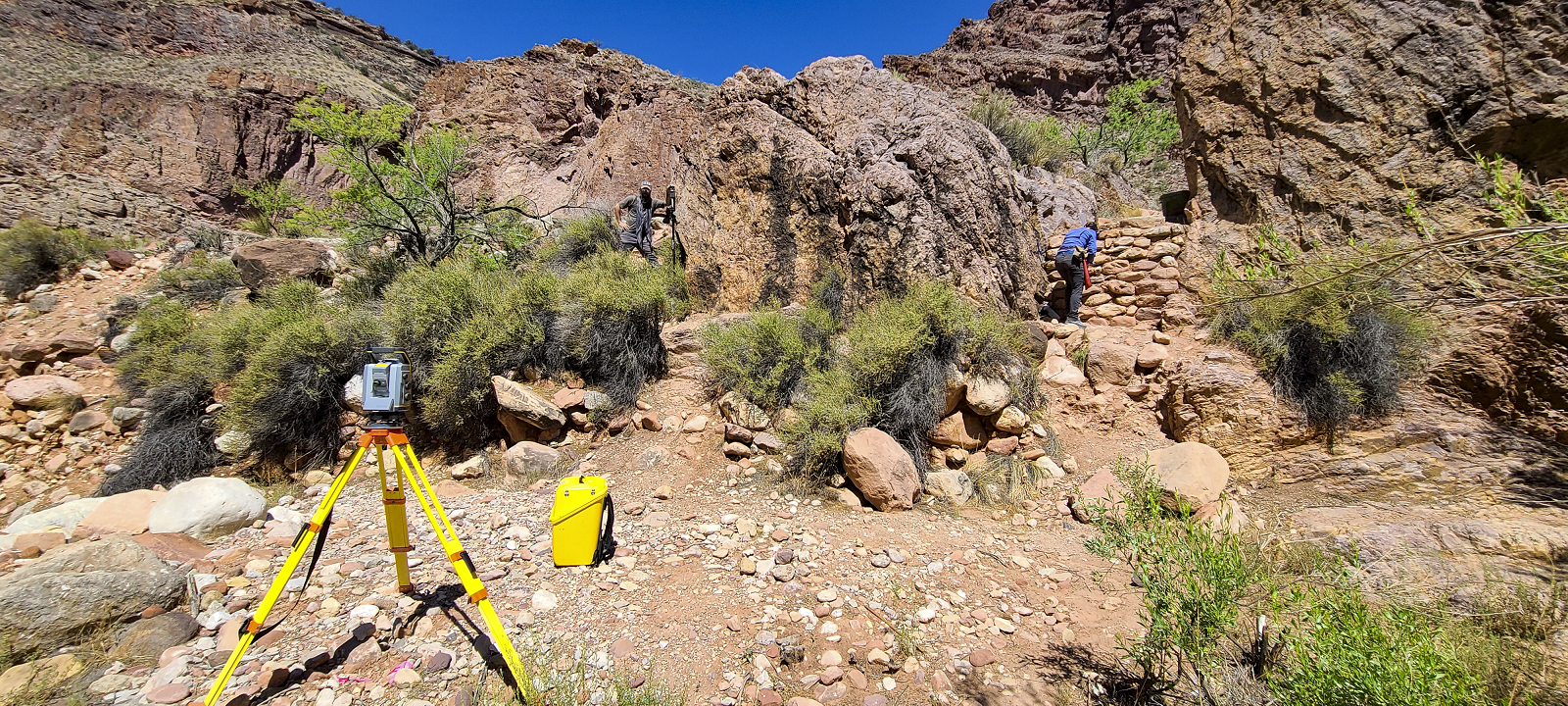
The terrain was challenging with large boulders, steep cliffs, and a creek that needed to be crossed several times. Arizona Surveying used a Trimble S7 Total Station and a pair of Trimble R10/R12i GPS Receivers to collect the topographic data needed. Bridge abutments were surveyed along with the existing bolt patterns so that the new bridge could be dropped right into place where the old bridge once sat. All data gathered was processed through Trimble Business Center using Arizona Central State Plane values. Bretton and Bryan also set four 5/8” rebars with aluminum caps on top as control points for future work in that area.
The team finished up around noon and the park ranger that had accompanied the team lead them to the Ribbon Falls. As he put it “you might as well see what the bridge is for”. After a short hike the team arrived at the falls and what a sight to see, paradise tucked away inside the canyon. Ribbon falls is not an easy location to get to. Located 11.9 miles north from Phantom Ranch and generally considered a challenging hike, but worth the effort once you gaze upon the falls. The falls are about 100 feet high, and the mineral rich water has created a giant travertine spire below the falls. The trail also gives you access to hike up around the falls and view the Grand Canyon through there.
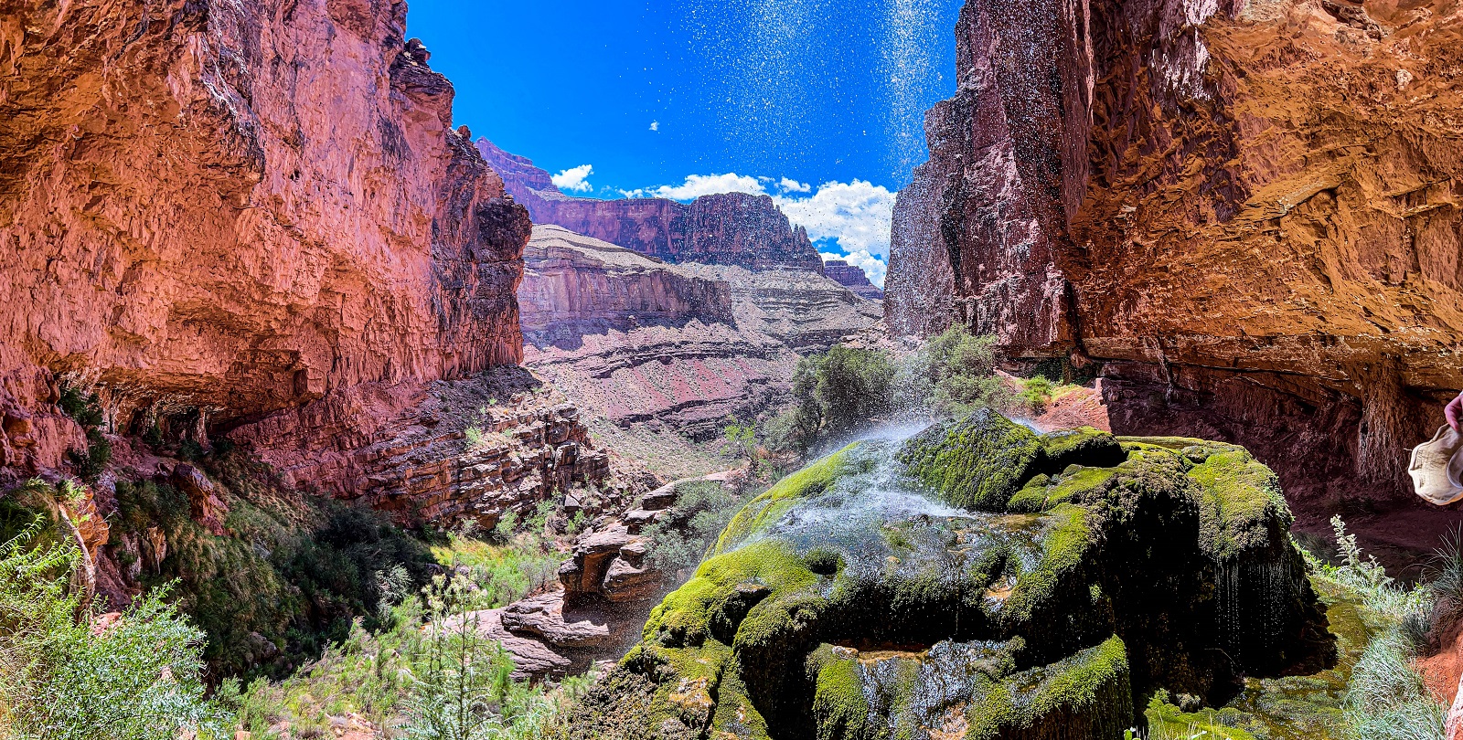
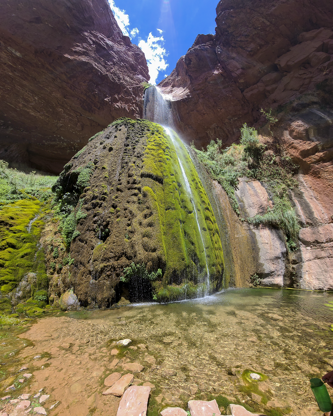
The team got to cool off from the mid-day heat by standing in falls, letting the cold water shower them, its just what was needed after a long hot day in the sun. In the pools on top of the travertine there were frogs and butterfly’s, things you wouldn’t expect to see in the Grand Canyon.
After the team all had a chance to cool off and take in the breathtaking falls they headed back to the site, packed up their gear and equipment to be airlifted out. After that it was a short hike back to Cottonwood Campground for the team’s helicopter ride out of the canyon. Once at Cottonwood the team was delayed for 3 hours because of search and rescue cases of heat exhaustion in the canyon by the park service. Fluid/electrolyte loss can exceed 2 quarts per hour if you hike uphill in direct sunlight and during the hottest time of the day. Due to inner canyon air being so dry and hot, sweat evaporates instantly, making its loss almost imperceptible.
The Arizona Surveying Team knows the dangers all to well, having worked now in the Grand Canyon on multiple occasions, the team takes every precaution while working there. Bringing lots of food/water and staying in constant communication with each other, and knowing the initial signs of heat exhaustion are crucial safety precautions taken when in the field. The Grand Canyon is a dangerous place but minimizing the risk and taking precautions makes all the difference. We at Arizona Surveying are very proud to be able to work with the U.S. National Parks Service in helping preserve this beautiful natural wonder.