
By now most of us have seen or at least heard of UAV’s, aka: drones–those mini aerial vehicles (unmanned) that follow extreme skiers down snow-covered chutes nobody in their right mind would actually ski. Or maybe a drone photographed your virtual house tour on Zillow. But drones have many other applications, serious ones, that it might pay to understand if you ever need a professional service revolutionized by drone technology.
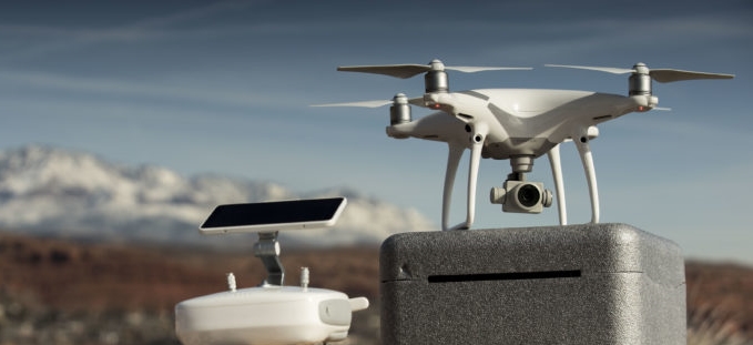
One of those services is Land Surveying. UAV’s can now be fitted with technology that enables Licensed Land Surveyors to deliver services such as Topographic Mapping, Orthophotography, surface modeling, survey-grade point clouds and aerial photography using a drone as the primary source of data collection.
But as the “cost of entry” into the UAV/drone space decreases, the number of under-qualified or dubious operators increases. This is where the scene becomes crowded and it pays to know who you’re working with and what their actual experience and capabilities are. With a drone’s simplified software and ease of use, quasi-professionals are stepping up and offering mapping-related services to consumers in related industries. But it’s less than clear what they are getting and if the data and information received is actually correct and what they need.
That’s why the value of a Licensed Land Surveyor for controlling and processing drone-collected mapping data cannot be dismissed. For example, UAV’s have the ability to provide very accurate data, provided the results are checked and verified against known control. What I mean by “known control” is mathematical ties to survey-grade reference points with established and verified vertical and horizontal values in a relevant datum. But what if there are no control ties or verification? Or what if a correction is required? There is a reason Land Surveying requires a license.
In the state of Arizona, by statute a Land Surveyor is defined as: “someone who by reason of knowledge of the mathematical and physical sciences, principles of Land Surveying and evidence gathering acquired by professional education or practical experience, or both, is qualified to practice Land Surveying as attested by registration as a Land Surveyor.”
A Licensed Land Surveyor has a duty to protect the public which is the primary reason for licensure. In Arizona and most other states, there are government agencies or boards that manage and oversee technical registration and enforce state statutes and board rules related to surveying when necessary. Once again, for the protection of the public. When a consumer contracts with a licensed professional there is protection and recourse if things go wrong.
A drone with advanced software tools can make it look easy but errors are possible and “what if’s” a real concern. What if a map made by an unlicensed provider is incorrect and engineering calculations or designs are based upon it costing a contractor or project owner money? Who is financially responsible? Does the unlicensed provider have professional liability insurance like a Licensed Land Surveyor would? In yet another scenario: What if collected mapping data makes it into a court of law? Will it have any validity if provided by an unlicensed operator?
These are all questions with implications that need to be answered before entering into agreements with any unlicensed provider. Without the protection a license provides, you are ultimately responsible for the mapping product somebody else produced with all that implies legally and financially. Are you willing to take that risk for a perceived bargain? As with any service transaction, expect to get what you pay for.
Licensed Land Surveyors are uniquely qualified and trained to provide aerial drone mapping products and services. We understand the operational and technical standards needed to safely and accurately use and apply UAV/drone technology. We are excited about the cost and efficiency advantages that mapping and surveying with drones has to offer and look forward to sharing our enthusiasm and expertise with our customers.

My aunt has been thinking about getting her land surveyed in order to understand any problems that it might have, and what she needs to fix. She would really like to get some help from a professional to make sure that they can prevent any accidents in order to be safer. I liked what you said about how software tools on a drone could allow them to understand the right license to make sure that it is more valid.
I appreciated it when you shared that it is great to hire a land surveyor who has a duty to protect the public which is the primary reason for licensure. In this way, he helps to ensure that the boundaries of the area can be achieved. I would like to think if a company needs to hire a land surveyor, it should consider hiring the one that is reliable and experienced.