
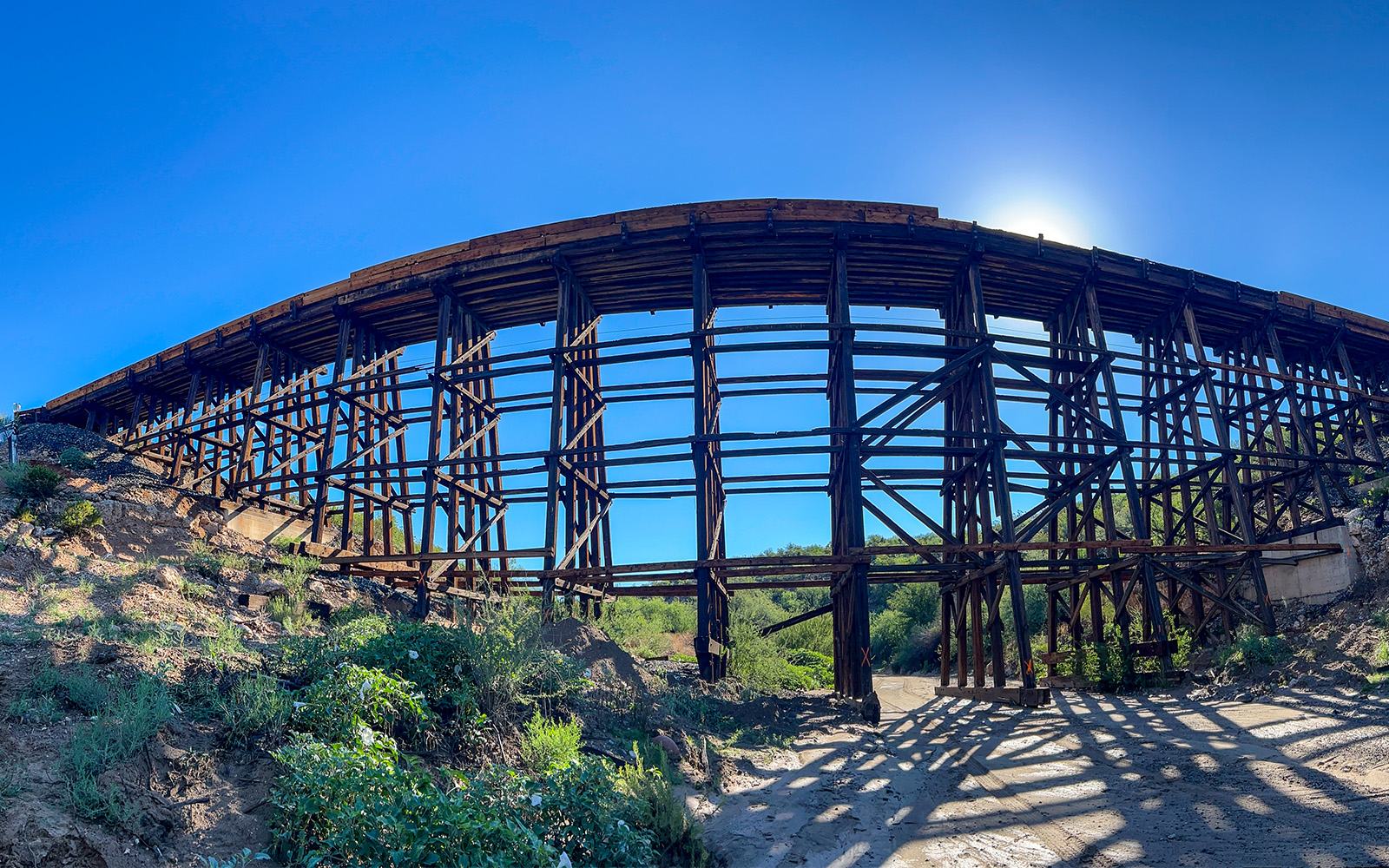
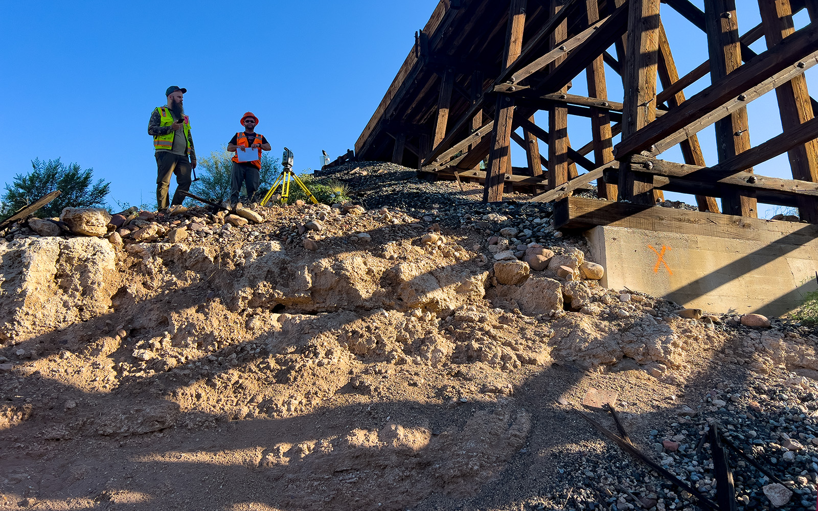
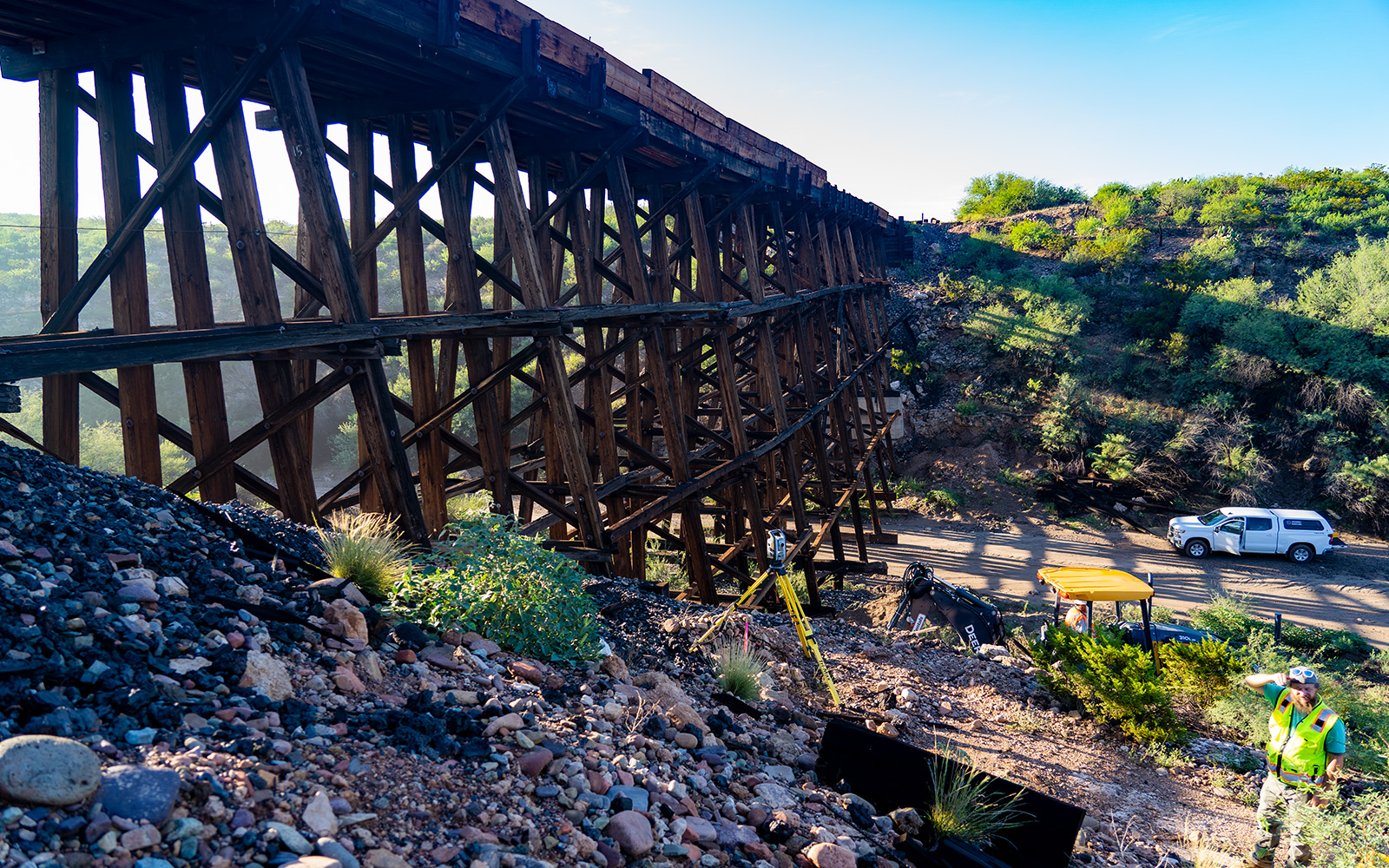
Arizona Surveying was tasked with locating the rail gage line for both rails in both approaches at the backwall, the rail gage line at each bend, the top corners of both backwalls and top corners of all existing piers for an Arizona Eastern Railway Bridge in Peridot, AZ.
Peridot, AZ (Western Apache Tséé Dotłʼizh “Blue Rock”) named for the mineral peridot found in basalt flows near by. The bridge located on the San Carlos Apache Indian Reservation about 200 miles southeast of Flagstaff, AZ.
Arizona Eastern Railway (AE) was chartered as the Gila Valley, Globe and Northern Railway (GVGN) on January 5, 1885. Before completion to Globe in 1899, the GVGN came under the control of the AE. The AE was leased by the Southern Pacific Railroad in 1905 and merged into the Southern Pacific system in 1924. AE was purchased by Genesee & Wyoming Inc. in 2011. Peridot is 47.2 miles from the start of the line in Miami, AZ and ends in Bowie, AZ.
The bridge crosses a wash that when flowing drains into the San Carlos River from the Hollywood Bowl Tank to the northeast. The bridge connects Miami and Safford for freight rail.
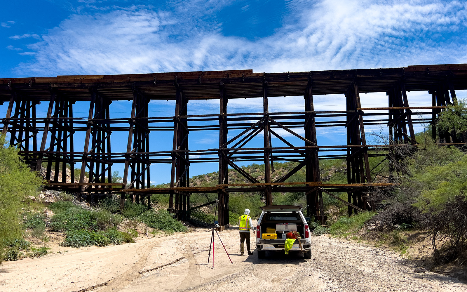
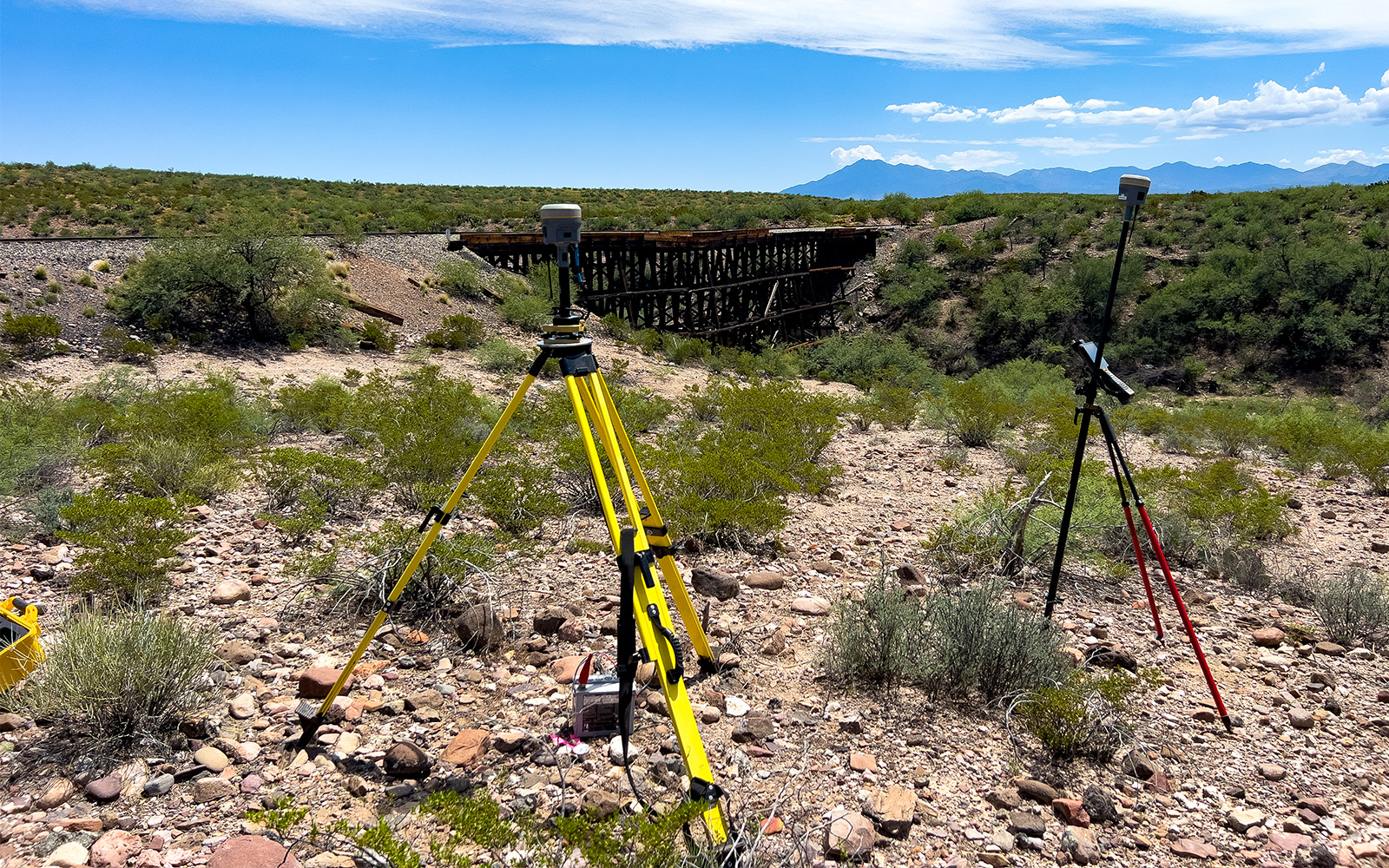
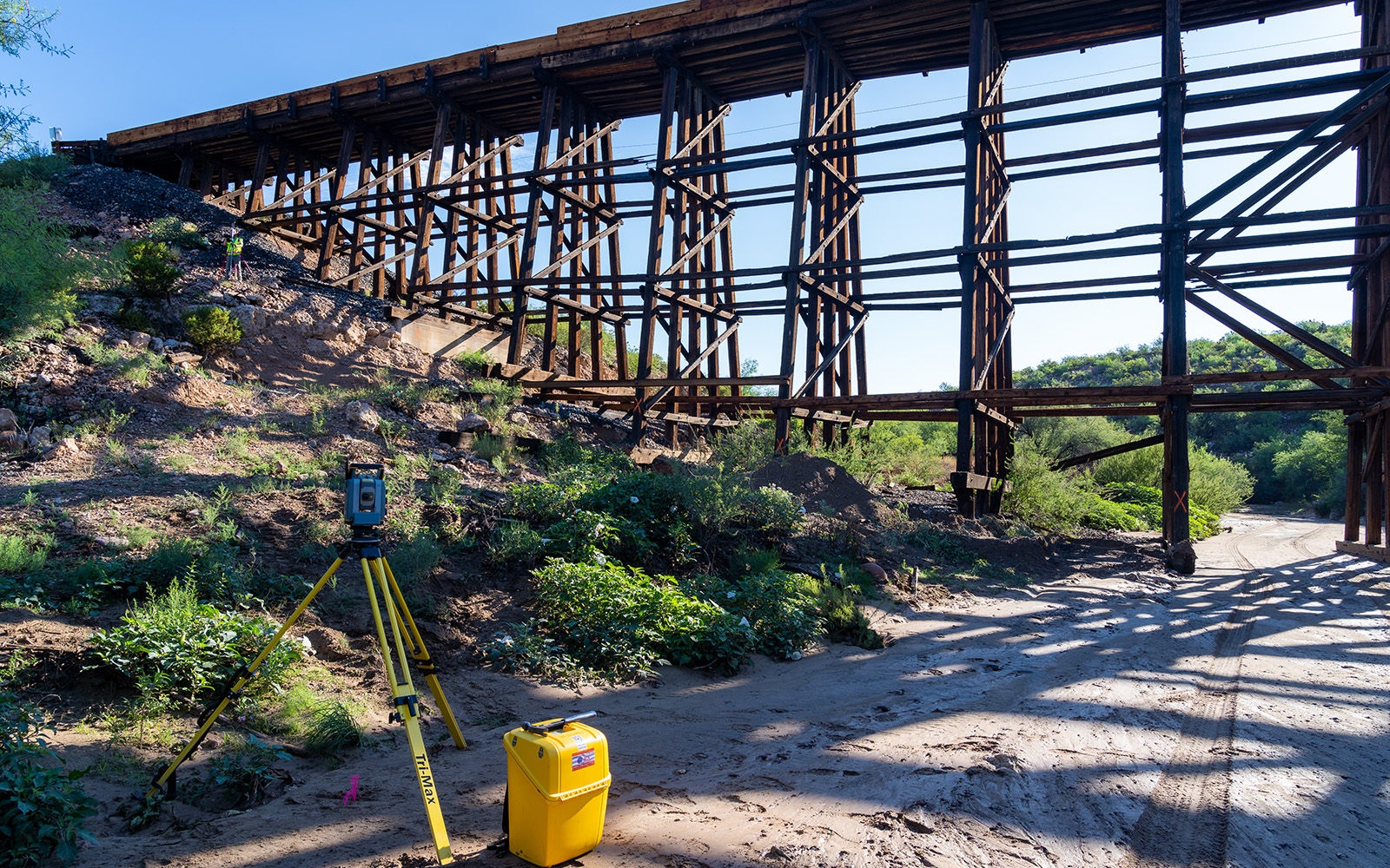
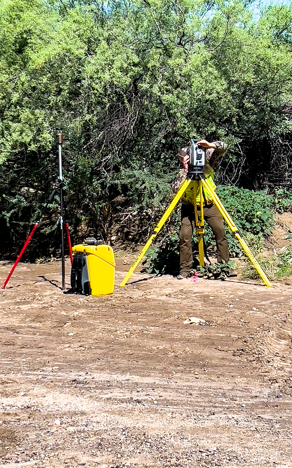
The bridge was located using a Trimble S7 Total Station and a Trimble Multi-Track Prism for high accuracy on the lower parts of the bridge. For the upper parts where a crew man could not safely locate the top over hangs of the bridge the S7’s Direct Reflex feature DR Plus was used. Trimble DR Plus range measurement technology provides extended range of Direct Reflex measurement without a prism.
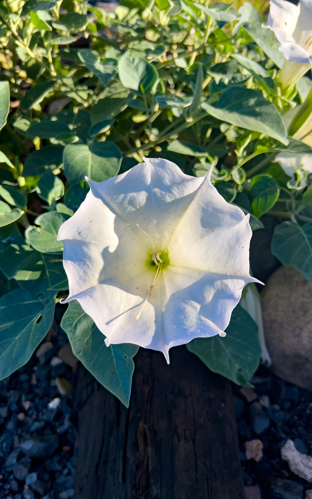
This was great experience for Arizona Surveying in an area we typically don’t work in. This part of Arizona offered many amazing things to see, but also had its dangers being very remote. Rattle Snakes are common in this area along with Datura, a poisonous plant that covered the ground. Near by is San Carlos Lake which was formed by the Coolidge Dam which is worth checking out.
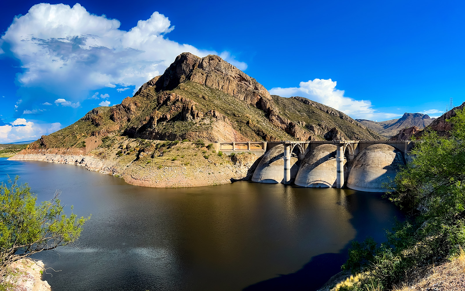
The Coolidge Dam is a reinforced concrete multiple dome and buttress dam. Built between 1924 and 1928, the Coolidge Dam was part of the San Carlos Irrigation Project. It’s named after the 30th US President, Calvin Coolidge and was dedicated by President Coolidge on March 4, 1930. The design and construction engineer was Herman Neuffer, who oversaw much of the construction undertaken by the Bureau of Indian Affairs (BIA) during the 1920s in Arizona and New Mexico.
San Carlos Lake exits the dam and into the Gila River and makes its way to the Salt River in Phoenix.
Bicyclists can ride the access road to the dam face and back. The route is scenic and little-traveled, and rises a total of about 700 feet along the 13 mile route. The elevation at the dam is about the same as the starting point, so the trip is not strictly a climb, but peaks about the middle of the distance and then descends again to about 2,600 ft.
When they reach the dam, cyclists can either return to the starting point along the two-lane paved road, or they can continue eastward along the rougher part of the road until it rejoins U.S. Route 70. Before traveling on the reservation, non-tribe members must obtain a permit. A mountain bike or other rugged type bicycle is recommended for cyclists traveling east from the dam to Rte 70.