
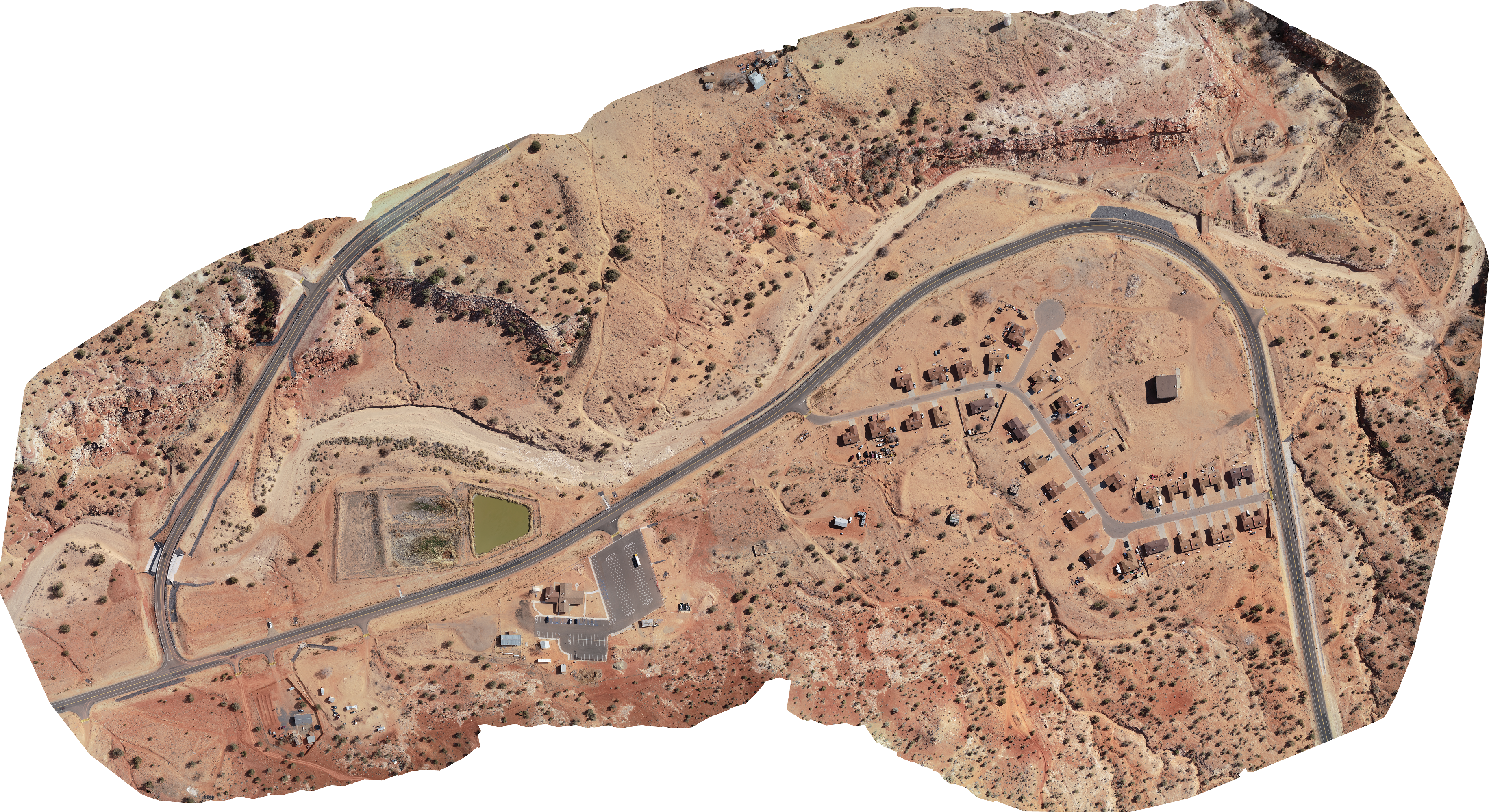
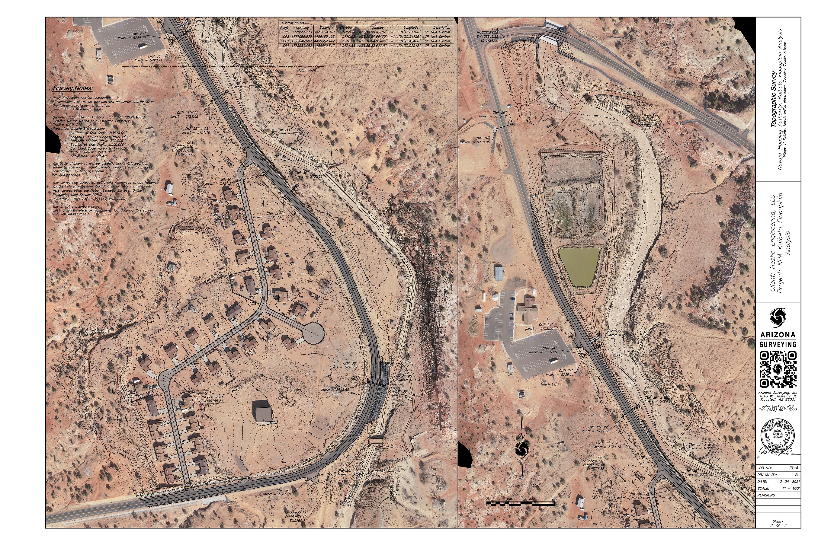
Aerial Done Services used in the Navajo Housing Authority (NHA) Kaibeto Floodplain Analysis of 109 acre area in Kaibeto, AZ. This topography survey was for a drainage study of the area and Arizona Surveying was able to provide aerial photogrammetric flight services, flown at approximately 400 feet above the ground.
Arizona Surveying used existing control points set by Navajo Housing Authority surveyors and added more for accurate coordinate system. We were able to provide data on the Navajo Nation Low Distortion Projection for ease of use for the client. After the drone flight was complete and data gathered from GPS, we provided a 2D orthophoto mosaic and a 3D DSM file in tif format.
The tif files were used in combination to create a 3D orthophoto mosaic, which can be used to create additional data outputs, such as a point cloud, point grids and break lines and can be imported into AutoCAD, Civil 3D, Carlson, etc., on the project coordinate system, for project design, overlays, exhibits, etc.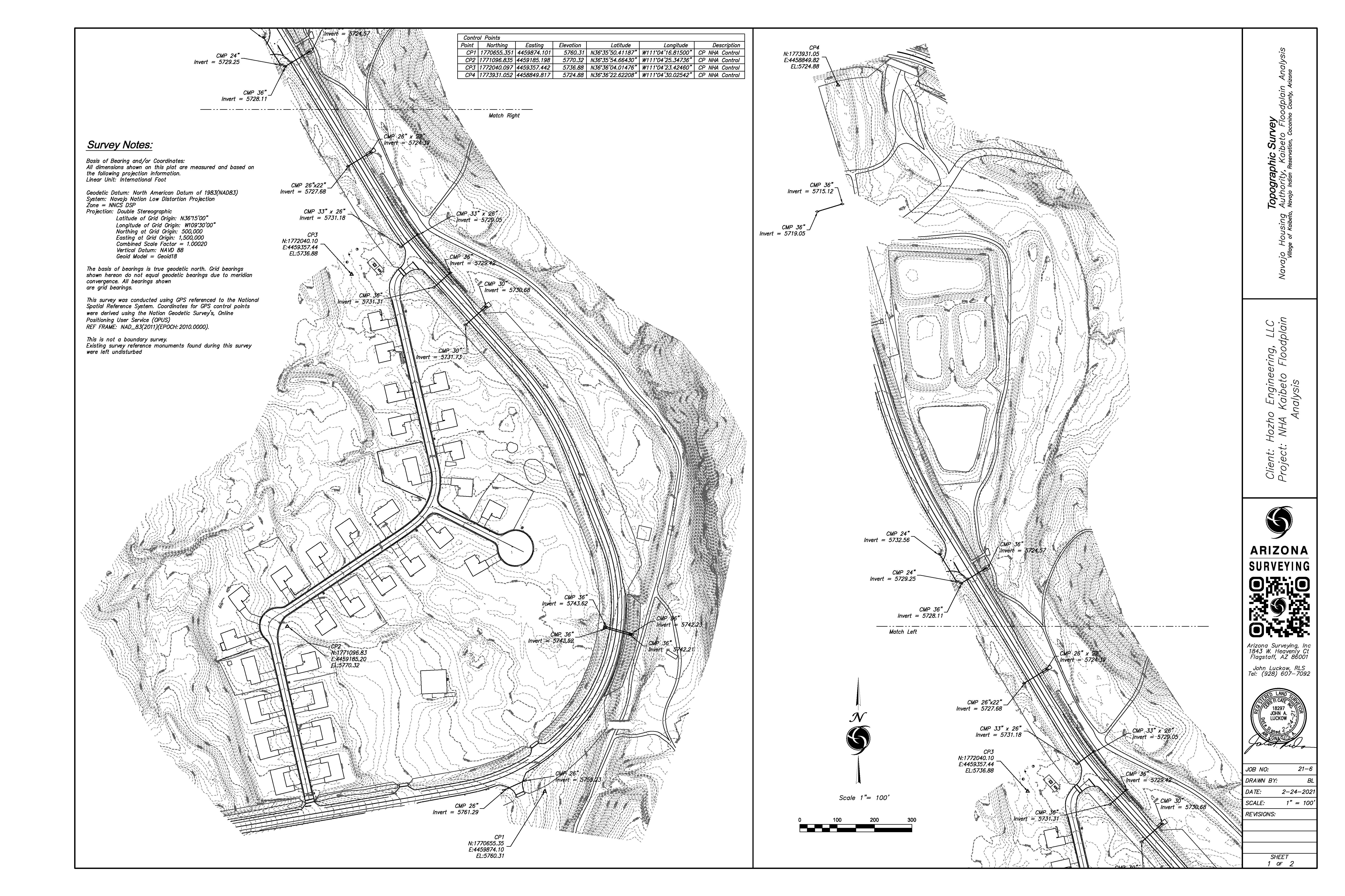